

Permaculture Site Plan with Water Flow - AI Generated Image with Photorealistic

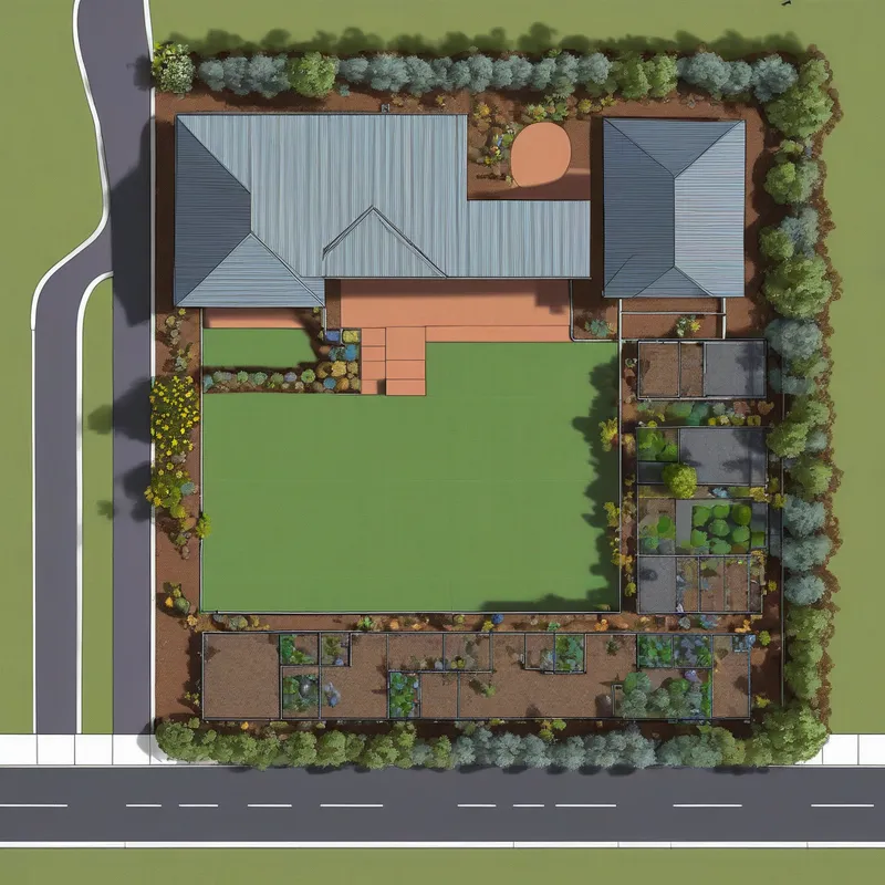
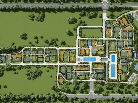
Permaculture Site Plan with Water Flow - A highly detailed, realistic, top-down site plan of a 140m x 50m block designed for a permaculture property in Regency Downs. Show the following: bitumen driveways, Colorbond (monument color) fences around the property, and a matching Colorbond back shed (6x9 meters, three roller doors and one pedestrian door at the front, monument color) sited in the top left corner. Display a centrally located house pad with realistic terraces made from block retaining walls, spaced by 1.5m, descending from the shed to the house. Show native plants and landscaping typical for the region. Include a back dam (behind the shed, oval/kidney-shaped, with visible filter layers), a creek flowing from the back dam through the terraces and vegetation, a naturalistic swim pond mid-slope, and a front dam at the lower right corner with visibly distinct filtration and pump system. Use arrows and subtle labels to indicate the closed-loop water flow: front dam → solar pump → back dam → creek → swim pond → front dam. Bicton-like water bodies with realistic reflections and natural outlines. Ensure all site elements (structures, vegetation, water flows) are cleanly drawn and visually distinct for planning. No vehicles or people. Clear and uncluttered layout for use as a planning reference. - AI image generated with Photorealistic

More like this

Permaculture Site Plan with Water Flow

A highly detailed, realistic, top-down site plan of a 140m x 50m block designed for a permaculture property in Regency Downs. Show the following: bitumen driveways, Colorbond (monument color) fences around the property, and a matching Colorbond back shed (6x9 meters, three roller doors and one pedestrian door at the front, monument color) sited in the top left corner. Display a centrally located house pad with realistic terraces made from block retaining walls, spaced by 1.5m, descending from the shed to the house. Show native plants and landscaping typical for the region. Include a back dam (behind the shed, oval/kidney-shaped, with visible filter layers), a creek flowing from the back dam through the terraces and vegetation, a naturalistic swim pond mid-slope, and a front dam at the lower right corner with visibly distinct filtration and pump system. Use arrows and subtle labels to indicate the closed-loop water flow: front dam → solar pump → back dam → creek → swim pond → front dam. Bicton-like water bodies with realistic reflections and natural outlines. Ensure all site elements (structures, vegetation, water flows) are cleanly drawn and visually distinct for planning. No vehicles or people. Clear and uncluttered layout for use as a planning reference.

Photorealistic, Size: 1024 x 1024
 0 Likes
 106 Views

Make your own version

Start from this image's prompt and change anything you like.

Photorealistic
⭐⭐⭐⭐⭐

Good Inspiration

“Used it during the 1 Day Free Trial and was able to come up with a good amount of cool illustrations. This is an awesome platform to get inspiration when you catch yourself in a mental freeze. Currently on the $5 monthly plan but am already thinking about an upgrade to see how much more I can get out of it. Won't hurt to try it.”
— Micah

Frequently Asked Questions

Can I use the AI-generated images commercially?

Yes. All images created with Tangra AI are copyright-free and fully approved for commercial use, with no attribution required.

What AI models are used to create these images?

Tangra AI uses a curated mix of the best-performing industry models like Flux, DALL·E, Nano Banana 2, and Stable Diffusion alongside our own proprietary models to deliver consistently high-quality, production-ready images.

Can I edit the images after they are generated?

Yes. Tangra AI includes powerful editing tools that let you refine and adjust your images after they're generated.